The name Drabeng
The name Drabeng is unique among Norwegian gårdsnavn; a search for "Drabeng" in the standard work, i.e. O. Ryghs series "Norske Gaardnavne" (18 vol.), gives one result (try it).
99. Drabeng. Udt. dra:2bæng; ogsaa hørt dra:2bænk, bænken">dra:2bænken (kvænsk Modifikation?). -- Drob Eng 1723. [Drapeng 1776]. Enestaaende Navn, som formodentlig har sin Grund i nogen tilfældig Begivenhed.
vol.17, p.158
What the chance circumstances that led to the name were, we shall probably never know. But there is no doubt about the name and how to spell it: Drabeng. This is the way it is spelt in gårdsmatrikkel (1876), Matrikkelutkastet (1950), Lyngen parish records (1751- ), census records (1801, 1865, 1875, 1900), Troms skifteregistret (1690-1805, etc), Cappelens and nearly everywhere else.
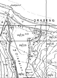
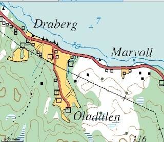
Nearly everywhere else, but not always in Statens Kartverk. For some reason or another, Statens Kartverk has difficulty in getting names right! In their web-service, Norgesglasset, which provides online maps, Drabeng is correctly given as such at the largest scale,
| The largest scale of map shows individual property boundaries, and gets the name right. |  |
| Other scales usually get the name wrong. | |
 |
Why this unfortunate error? |
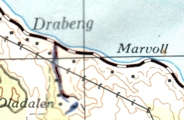
| It seems to be due due to a careless reading of previous editions (e.g. Sheet 1634 III Series M711, Edition 1_AMS), where the letter n is partly obscured by a grid-line. |  |
We shouldn't be too paranoid about this, since there are many other strange names in Norgesglasset.
For example:* Verified by field observation during June 2005.
Version in Norgesglasset Name* Draberg Drabeng Elvejorda Elvejord Rotenvik Rottenvik Svensbu Svensby
But it would be nice, if Statens Kartverk were to update their databases to mirror the correct names.
Up-date
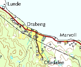
| Norgesglasset was up-dated during 2006 and the strange variants in the table above have been corrected in the data for the 1:50 000 maps. |  |